
During National Surveyors Week, it’s a great time to highlight some of the foundational concepts that shape how land is measured, divided, and ultimately developed. One of those concepts is the aliquot lot.
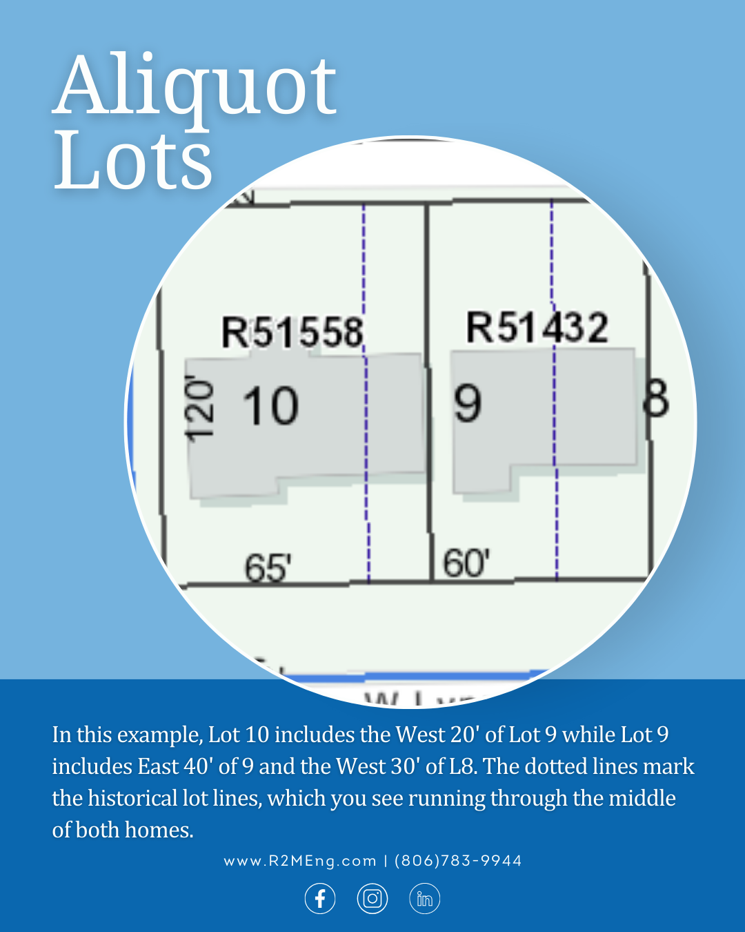
Aliquot lots are standardized divisions of land used within the Public Land Survey System (PLSS). In this system, land is divided into townships and sections, and those sections are further broken down into smaller, uniform parts (typically halves, quarters, or quarter-quarters). A similar approach is also used within subdivisions, where portions of platted lots may be described by measured divisions, such as, “the east 50 feet of Lot 3.” These divisions, known as aliquot parts, create a consistent framework for describing property boundaries.
While the concept may sound simple, applying it in the real world requires precision and expertise. Surveyors must account for historical data, physical land conditions, and previous measurements to accurately locate and define these boundaries on the ground. What appears as a clean division on paper doesn’t always translate perfectly in the field.
Aliquot lots play a critical role in land development, infrastructure planning, and property ownership. They provide a common language that engineers, surveyors, developers, and regulatory agencies rely on to ensure clarity and consistency across projects.
At R2M Engineering, our survey team works at the intersection of technical accuracy and real-world application, helping clients move forward with confidence starting from the ground up. Explore our surveying services to see how we can support your next project.